Redirect ItemDetail
The link that you are referencing is outdated!
If the item currently exists in our website, it is displayed below. If not, the link that you are referencing is no longer valid and no longer exists on our website. We will have some collections moved in the coming months. See what's coming in updates for Signature Collections or Digital WHILBR Collections on ContentDM.
If the item currently exists in our website, it is displayed below. If not, the link that you are referencing is no longer valid and no longer exists on our website. We will have some collections moved in the coming months. See what's coming in updates for Signature Collections or Digital WHILBR Collections on ContentDM.
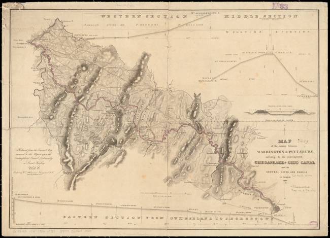
MAP of the country between WASHINGTON & PITTSBURG refering to the contemplated CHESAPEAKE & OHIO CANAL
and its GENERAL ROUTE AND PROFILE OCTOBER 1826
Reduced from the General Map annexed to the Report upon the Contemplated Canal and drawn by
Lieut. Farley, USA.
Etched by Wm. Harrison, Georgetown, D.C.
Lettered by D.R. Harrison
Click image to Zoom in on clearer map.