Collection Name
Collection Name
About
About
Maps
Media Items
Media Items
Media Items
ItemID
wcco140
IDEntry
5920
Creator
Lieut. Farley, USA.
Date
1826
Collection Location
C&O National Historic Park
Original size
45 x 66 cms
Coverage
Maryland, 1824-1938
Body
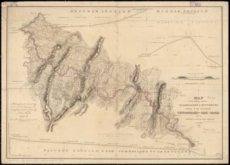
MAP of the country between WASHINGTON & PITTSBURG refering to the contemplated CHESAPEAKE & OHIO CANAL
and its GENERAL ROUTE AND PROFILE OCTOBER 1826
Reduced from the General Map annexed to the Report upon the Contemplated Canal and drawn by
Lieut. Farley, USA.
Etched by Wm. Harrison, Georgetown, D.C.
Lettered by D.R. Harrison
Click image to Zoom in on clearer map.