Redirect ItemDetail
The link that you are referencing is outdated!
If the item currently exists in our website, it is displayed below. If not, the link that you are referencing is no longer valid and no longer exists on our website. We will have some collections moved in the coming months. See what's coming in updates for Signature Collections or Digital WHILBR Collections on ContentDM.
If the item currently exists in our website, it is displayed below. If not, the link that you are referencing is no longer valid and no longer exists on our website. We will have some collections moved in the coming months. See what's coming in updates for Signature Collections or Digital WHILBR Collections on ContentDM.
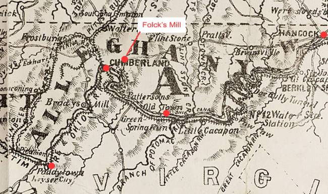
This map, based on an 1875 map of Allegany County, marks in red the towns of Hancock, Cumberland, Old Town (along the C&O Canal and the Potomac River) and Paddy Town.