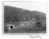
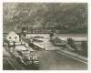
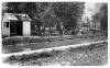
At upper lock above Harper Ferry
Media Items

Collection Name
About
Body
At upper lock above Harper Ferry. Maryland Heights in the distance.
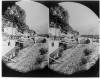
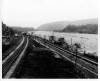
The photograph is taken looking down the canal toward lock 35 which is just above the inlet canal from behind Dam 3.