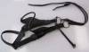
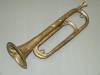
Bugle belonging to Robert L. Hebb
Media Items
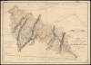
Collection Name
About
Body
This bugle belonged to Robert Luther Hebb (1873 – 1936) of Sharpsburg. The bugle was used to alert the locktender that a boat was approaching the lock, so that the lock was ready to receive a boat. Some boatmen used horns, others shouted, but the purpose was the same - to have the tender at the lock ready to open and close gates and facilitate the passage of the boat on its way.