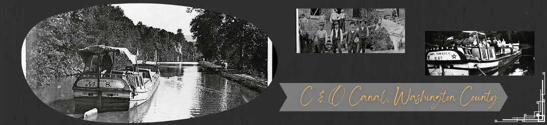
The economic impact of the C&O Canal on canal communities in Washington County, Maryland
The Chesapeake and Ohio Canal, begun in Washington DC in 1828 and completed to Cumberland by 1850, paralleled the Potomac River on the Maryland shore. It was intended to open a transportation route to the west, using the water from the river to carry the load. Throughout its 22 years of construction and nearly a century of operation, the canal was home to countless men, women, and children who worked at locks or on boats. In addition it employed a wide variety of craftsmen, laborers, engineers, and administrative or supervisory personnel. The canal was used by the large coal companies, and also by farmers, businesses, and individuals to transport goods in both directions, ranging from farm produce to stone, cement and lumber.
The Canal in Washington County
More than 78 miles of the 184.5 miles of the Chesapeake and Ohio Canal lie in Washington County. Within these miles are found:
- 5 of the 11 stone aqueducts: Antietam, Conococheague, Licking Creek, Tonoloway, Sideling Hill Creek
- 4 of the 7 dams:
- Dam 3: 1.6 miles above Harpers Ferry
- Dam 4: 15 miles below Williamsport
- Dam 5: 7 miles above Williamsport
- Dam 6: 10.22 miles above Hancock
- 25 of the 74 lift locks (number 31 through 56)
- 2 of the 3 River Locks (Harpers Ferry and Shepherdstown)
- The only two slackwater navigations sections where the boats went out into the river: Big Slackwater behind Dam 4 (3.3 miles long) and Little Slackwater behind Dam 5 (1/2 mile long).
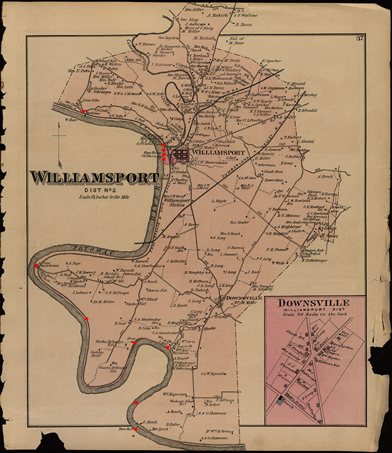
- Williamsport was the most important port on the canal except for those at the termini (Georgetown and Cumberland).
- Other important shipping points included:
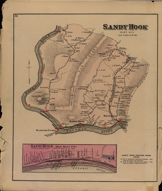
- Harpers Ferry/Sandy Hook area
- Bridgeport (across from Shepherdstown)
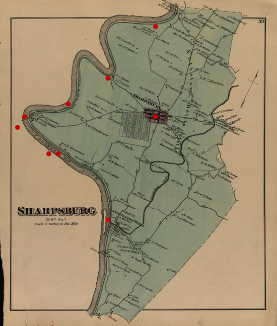
- Snyders Landing (served Sharpsburg)
- Four Locks
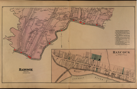
- Hancock
- Smaller wharfs and basins served local communities up and down the canal, like Briens Basin near Antietam Village.
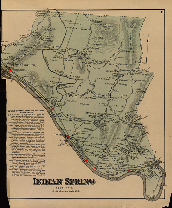
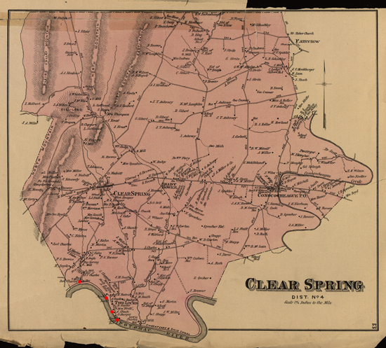
C & O Canal Maps | ||||||
|---|---|---|---|---|---|---|
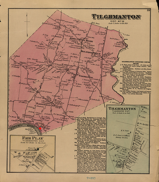
Hancock | Indian Spring | Clear Spring | Williamsport | Tilghmanton | Sharpsburg | Sandy Hook |
|
|
|
|
|
|
|
There were many industries and firms that operated along the canal or near. Among the most notable:
- Limestone quarries and kilns for making hydraulic cement that existed in many parts of the county. Their product was both used on canal structures and shipped on the canal. Examples - the Boteler mill below Shepherdstown, and the Round Top Cement Mill 3.3 miles above Hancock.
- Above Harpers Ferry in the Dargan Bend area were quarries and facilities worked by a number of mining companies.
- Grist Mills existed at many points, including three mills known at different times as Charles Mill
- Small warehouses were common along the canal, such as the Snyders Coal & Grain warehouse at Snyders Landing.
- Of the countless wharfs along the canal, the most notable and busy were likely those in Williamsport, including the Steffey and Findlay wharf near Lock 44 and the Cushwa wharf near the Conococheague Aqueduct.
- Stores also grew up along the canal at canal wharfs and locks (such as at lock 37, 38, at Four Locks) as well as in the small villages beside the canal such as Sandy Hook, Mercerville, Ernstville, Millstone, Park Head, and Pearre.
See A brief history of the Chesapeake and Ohio Canal
and Register of Canal Boats, C&O Canal, 1873-1876 and 1878.
For more history, see Historical Documents, and for access points to visit the canal see Access Points, from the C&O Canal Association's website.
Western Maryland Regional Library is grateful to the planning committee for this project: Sam Tamburro, Ahna Wilson and Karen Gray of the Chesapeake and Ohio National Historical Park and Carol Appenzellar, John Frye and Joseph Berger of the Washington County Free Library. Thanks are also extended to Randy Anderson, Doug Bast of the Boonsborough Museum of History, Enoch Pratt Library, Maternal and Child Health Group at Georgetown University, Patricia Hammond, the Hancock Historical Society, Barbara and Royce Hutchinson, Teresa Karimian, the New York State Library, Tim Snyder, the Western Maryland Railroad Historical Society of Union Bridge, and the Williamsport Town Museum.
This project was made possible by a grant from the PNC Foundation Legacy Project with support from the Maryland Humanities Council. The Maryland Humanities Council is an affiliate of the National Endowment for the Humanities. Any views, findings, conclusions, or recommendations expressed in these programs do not necessarily represent those of the PNC Foundation, the Maryland Humanities Council, or the National Endowment for the Humanities.
If you have additions, corrections, comments, or questions, please contact us by clicking on the Contact Webmaster below.