
National Park Service (NPS) resources

Unrau - Introduction and 1 - Designers

Media Items
Body

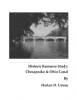
In the mid-1970s, National Park Service historian Harlan D. Unrau produced a major, handwritten, multi-volume study of the history, engineering, operation, maintenance, and other aspects of the Chesapeake & Ohio canal.

This is one chapter of the book. The entire text can be found at Chesapeake & Ohio Canal Historic Resource Study

Making of a park - Part 2

Media Items
Body

Chapter 6

EXPANDING THE PARK


The 1971 act finally gave the National Park Service the authority and means —with subsequent appropriations — to enlarge its narrow canal right-of-way into a viable park. Land acquisition was the primary purpose of the legislation and became the first priority following its enactment.

Ferry Hill Plantation House (Historic Structure Report, part 2)

Media Items
Body

Physical Description

Summary of Character


Defining Features

The character-defining features of the Ferry Hill Plantation House are discussed in four categories: sitting, massing, material use, and detailing. Each category will be addressed separately, although often features discussed within one area have significance and influence on another.

Setting/Siting:

Ferry Hill Plantation House (Historic Structure Report, part 1)

Media Items
Body

Built by 1820, the Ferry Hill Plantation House is a significant structure—considered architecturally, historically, and culturally. The property is located in the Conococheague District of the C&O Canal National Historical Park at mile-post 73.02. The house represents a fine example of rural Federal-style design. A great many of the property's character-defining features exist today in exceptional condition.

Farming along the Chesapeake and Ohio Canal, 1828-1971 (- A Study of Agricultural Sites)

Media Items
Body

The report that follows reveals the depth and richness of the agricultural history along the C&O Canal, and the close interrelationship between the canal and surrounding farms. Settlement along the fertile bottomlands of the Potomac River preceded construction of the canal by many years. As a result, the new canal passed through a well established agrarian landscape; some inhabitants were hostile to the canal due to property damage it would cause, others embraced it, while a substantial number fought to receive the highest monetary compensation that they could from the Canal Company.

Early Development of the Chesapeake and Ohio Canal Project

Media Items
Body

The Early Development of the Chesapeake and Ohio Canal Project.

INTRODUCTION.

The Chesapeake and Ohio Canal, as it exists to-day, lies on the north shore of the Potomac River, forming a navigable water-way between Georgetown, near the head of tide-water in the Potomac, and Cumberland, at the eastern
base of the Alleghany Mountains, where Will's Creek joins the Potomac. The canal is one hundred and eighty-six miles in length, sixty feet wide at the surface (with some ex-
ceptions) and six feet deep...

The Community of Four Locks

Media Items
Body

The community of Four Locks grew as a direct result of the C & O Canal and the businesses associated with Canal operations. This "permanent" community thrived as long as the canal was operating. Family names of Four Locks included the Florys, Flynns, Snyders, Meyers, Taylors, Fernsners, Bowers, Mouses, Harts, Mosiers, Brewers, and Crawford. At different times, however, two families - the Prathers and the Hassetts - played major roles in the founding and leadership of Four Locks, Maryland.