
Chesapeake and Ohio Canal--Maryland

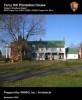
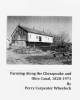
Ferry Hill Plantation House (Historic Structure Report, part 2)

Media Items
Body

Physical Description

Summary of Character


Defining Features

The character-defining features of the Ferry Hill Plantation House are discussed in four categories: sitting, massing, material use, and detailing. Each category will be addressed separately, although often features discussed within one area have significance and influence on another.

Setting/Siting:

Ferry Hill Plantation House (Historic Structure Report, part 1)

Media Items
Body

Built by 1820, the Ferry Hill Plantation House is a significant structure—considered architecturally, historically, and culturally. The property is located in the Conococheague District of the C&O Canal National Historical Park at mile-post 73.02. The house represents a fine example of rural Federal-style design. A great many of the property's character-defining features exist today in exceptional condition.

Farming along the Chesapeake and Ohio Canal, 1828-1971 (- A Study of Agricultural Sites)

Media Items
Body

The report that follows reveals the depth and richness of the agricultural history along the C&O Canal, and the close interrelationship between the canal and surrounding farms. Settlement along the fertile bottomlands of the Potomac River preceded construction of the canal by many years. As a result, the new canal passed through a well established agrarian landscape; some inhabitants were hostile to the canal due to property damage it would cause, others embraced it, while a substantial number fought to receive the highest monetary compensation that they could from the Canal Company.

Delapidation and Ruin, 1846

Media Items
About
Body

The length of the Chesapeake and Ohio Canal, if ever completed to the Ohio River as contemplated in its first projection will be 340 miles. The work was commenced in 1828 and vigourously prosecuted until the year 1839, when it had reached Dam 6, a point 135 miles above Georgetown, but for he want of means, the work thereon so was entirely suspended, leaving locks, dams and aqueducts partially finished, banks partly formed, and the whole exposed to delapidation and ruin - and in this condition it has since remained.

Early Development of the Chesapeake and Ohio Canal Project

Media Items
Body

The Early Development of the Chesapeake and Ohio Canal Project.

INTRODUCTION.

The Chesapeake and Ohio Canal, as it exists to-day, lies on the north shore of the Potomac River, forming a navigable water-way between Georgetown, near the head of tide-water in the Potomac, and Cumberland, at the eastern
base of the Alleghany Mountains, where Will's Creek joins the Potomac. The canal is one hundred and eighty-six miles in length, sixty feet wide at the surface (with some ex-
ceptions) and six feet deep...

The Community of Four Locks

Media Items
Body

The community of Four Locks grew as a direct result of the C & O Canal and the businesses associated with Canal operations. This "permanent" community thrived as long as the canal was operating. Family names of Four Locks included the Florys, Flynns, Snyders, Meyers, Taylors, Fernsners, Bowers, Mouses, Harts, Mosiers, Brewers, and Crawford. At different times, however, two families - the Prathers and the Hassetts - played major roles in the founding and leadership of Four Locks, Maryland.

Boat families on the C&O Canal (and the role of women and community)

Media Items
Body

This study addresses to what degree family participation in canal boat operations was driven by economic necessity versus a desire to stay together as a family unit or to participate in that lifestyle. As a parallel focus, I look at how the canal structured the family and community life of the canallers and how this may have changed through time. My research centers on the period from 1870 to 1924, during a transition from independent to company boatmen, and focuses on one community—Sharpsburg, Maryland—where a large number of canallers resided during this period.

Archeological Overview and Assessment (Part 2)

Media Items
Body

PART II:
HANCOCK TO CUMBERLAND MILEPOST 60.7 TO 184.5

Allegany County Historical Society Cumberland, Maryland

Cupler, Margaret D.
1971       
Allegany County, Maryland 1800 Census. Baltimore: Maryland Genealogical
Society.

Lowdermilk, William Harrison
1971       
History of Cumberland, (Maryland) from the Time of the Indian Town
Caiuctucuc, in 1728 to the Present Day. Reprint. Baltimore: Regional Publishing Company.